Locality Profiles
Locality Profiles
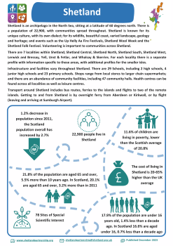
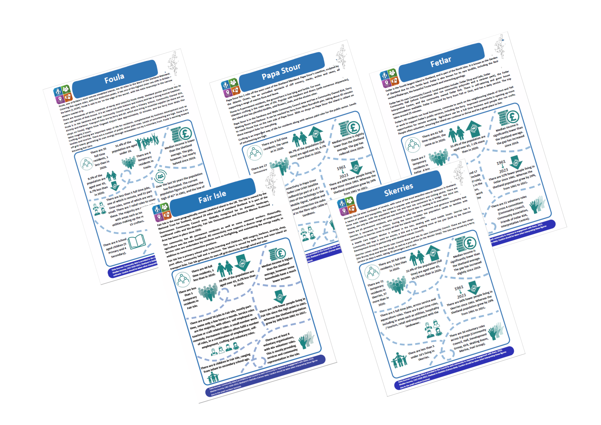
Locality Profiles provide detailed information at a local level. They are useful for a number of reasons including service redesign, local plans and maximising opportunities to seek external funding to support community development.
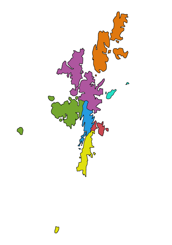
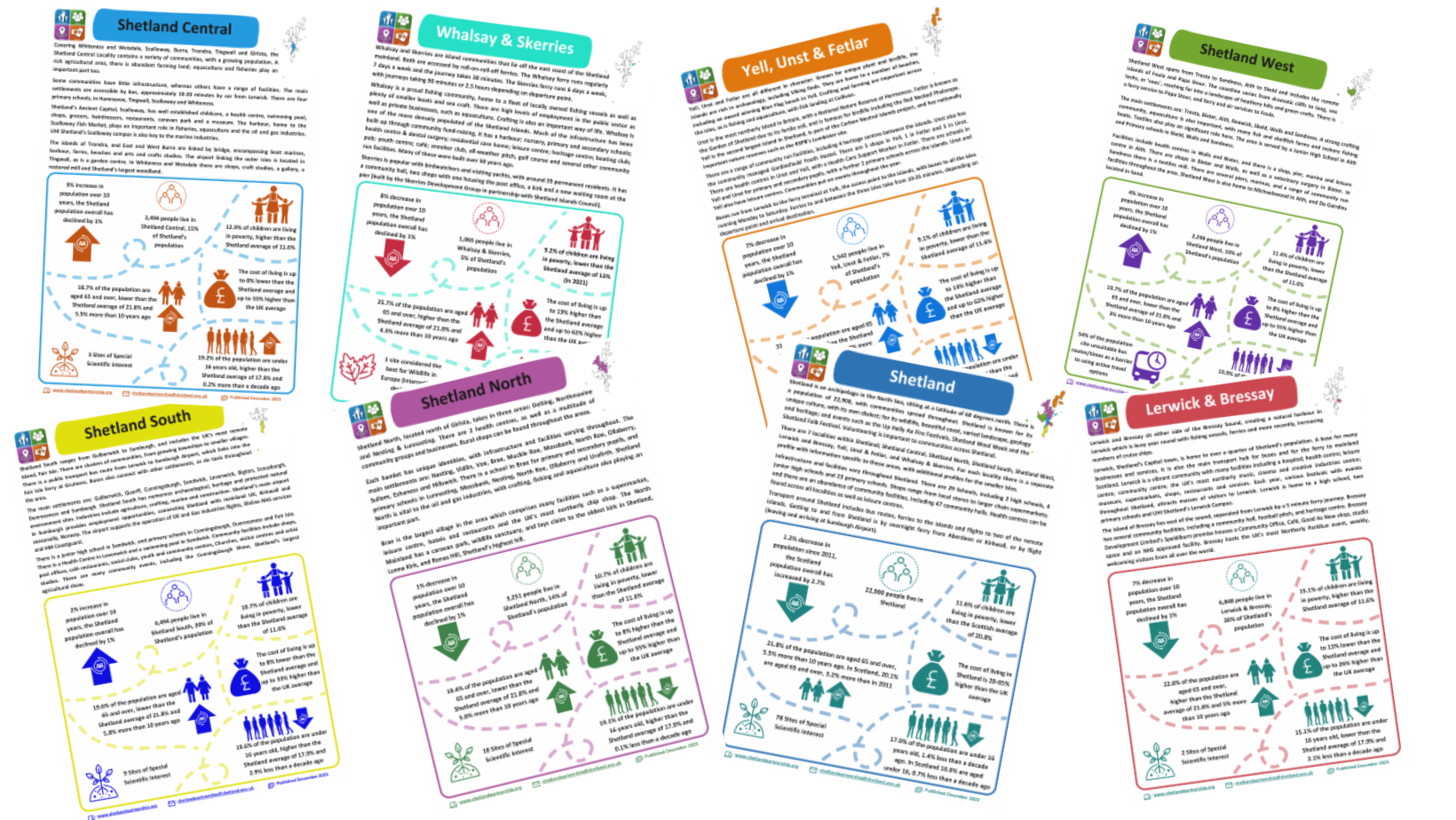
Shetland has 7 localities:
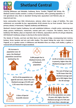
 Shetland Central
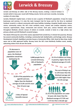
 Lerwick & Bressay
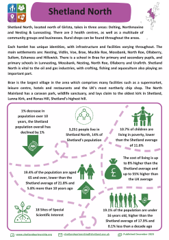
 Shetland North
 Shetland South
 Shetland West
 Whalsay & Skerries
 Yell, Unst & Fetlar
These Locality Profiles provide quantitative data on the following themes:
- Demographics
- Economy
- Education
- Environment
- Health
- Housing
Profiles shared here will be updated every two years. However the data will be monitored more regularly, with the most recent data available on request.